LNG Production Capacity: 13.12 MTPA (02 modules with capacity of 6.56 MTPA each).

The National Petroleum Institute, abbreviated as INP, established by Decree No 25/2004 of 20 August, is, under the terms of Law No 8/2026 of 3 June, Authority Regulator Oil in Mozambique.
It is active in the management, supervision and regulation of the oil industry.
In the exercise of its powers and powers, the INP shall have decision-making and sanctioning powers under the law. As the Oil Regulatory Authority, the INP is responsible, within the framework of its legal tasks, for the definition of guidelines for the participation of the public and private sectors, as well as for the licensing, regulation, supervision, supervision and control of oil operations activities.
It is supervised by the Minister who oversees the oil area (MIREME).
Administration of oil resources for social benefit, ensuring compliance with existing legislation and the sustainable development of the sector.
Reach full legal compliance, adopt international best practices, ensure optimal management and promote health, safety and environment.
Oil Law No 8/2026 of 3 June is the legal basis for the sector. The state owns the oil resources.
Governance is based on three pillars:
The State owns the oil resources. The INP acts as a regulator and ENH, E.P. ensures the commercial participation of the State.
Supreme legal base governing natural resources.
It regulates oil operations and the environment of the sector.
Sector regulatory instrument indicated as under review in the presentation.
Reference for research and production concession contracts.
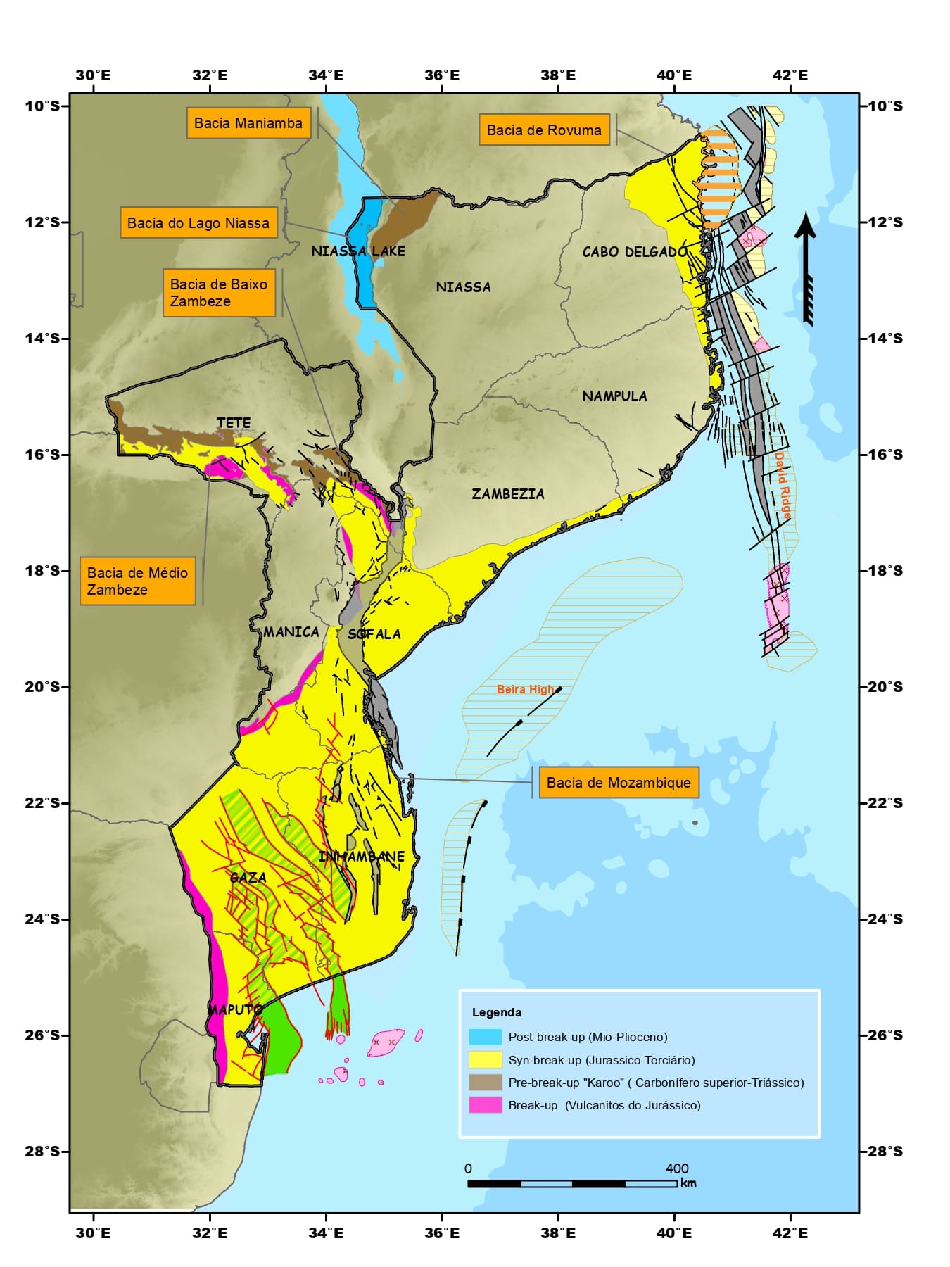
The exploration of hydrocarbons in Mozambique, which began in the 1900s, resulted in the historical discoveries of natural gas in Pande, Búzi and Temane in the 1960s, with the production to be started in 2004 in the Mozambique Basin, whose reserves total 6 trillion cubic feet (Tscf).
Six sedimentary basins mapped in Mozambique, the Rovuma Basin holds the greatest potential (~180 Tscf). The research began in 1904; commercial production started in 2004 in Pande–Temane.
Four layers of geological, geophysical, geochemical and drilling data reduce uncertainty about whether a basin contains hydrocarbons. The oil system only exists when mother rock, reservoir, seal, cheat and migration coincide in geological time.
Phase 02 · Assessment of the Oil PotentialOil system — migration from generating rock to cheating
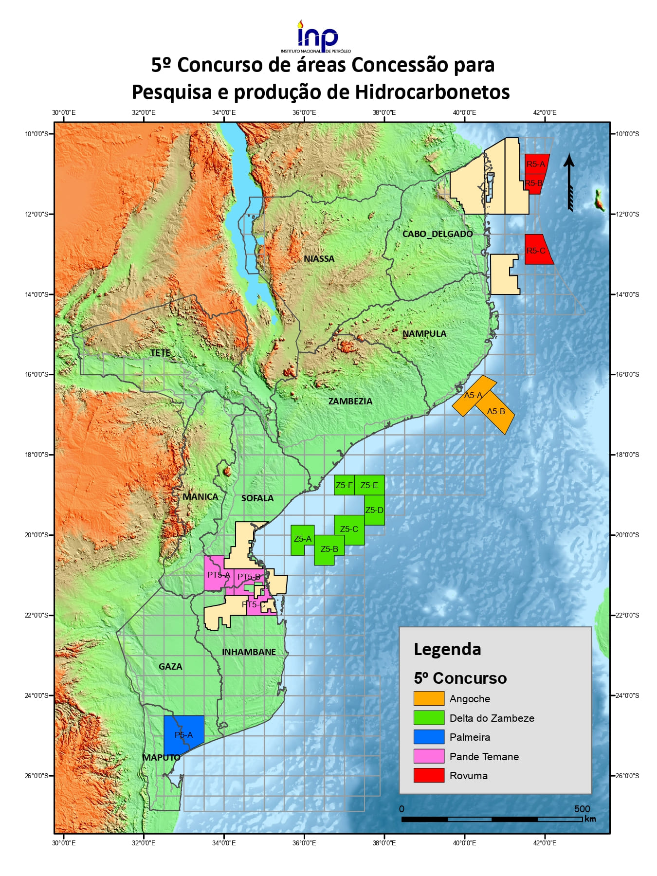
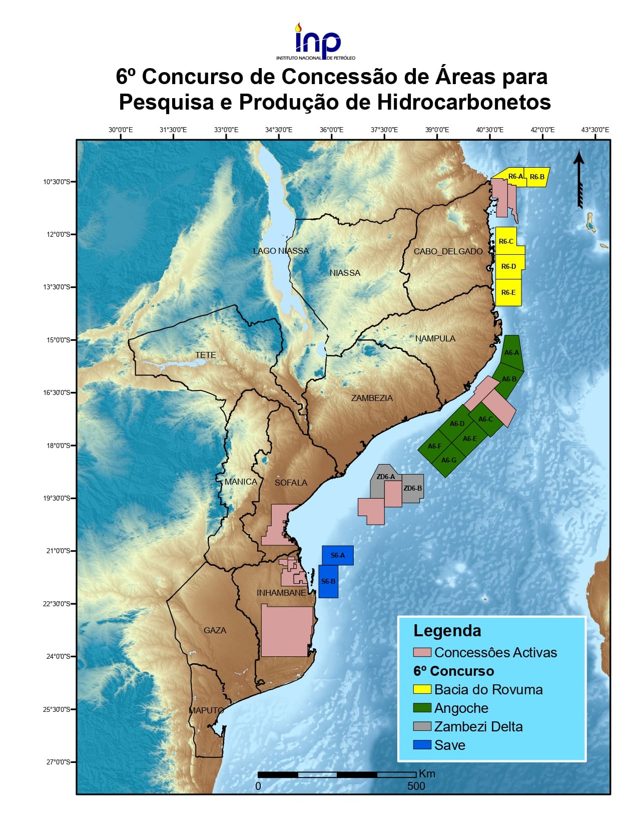
The sedimentary territory is organised in a regular mesh Grid 30′×30′ a cartographic basis to name areas of geological interest and consolidate the proposals before the public tender, on the basis of the Oil Law.
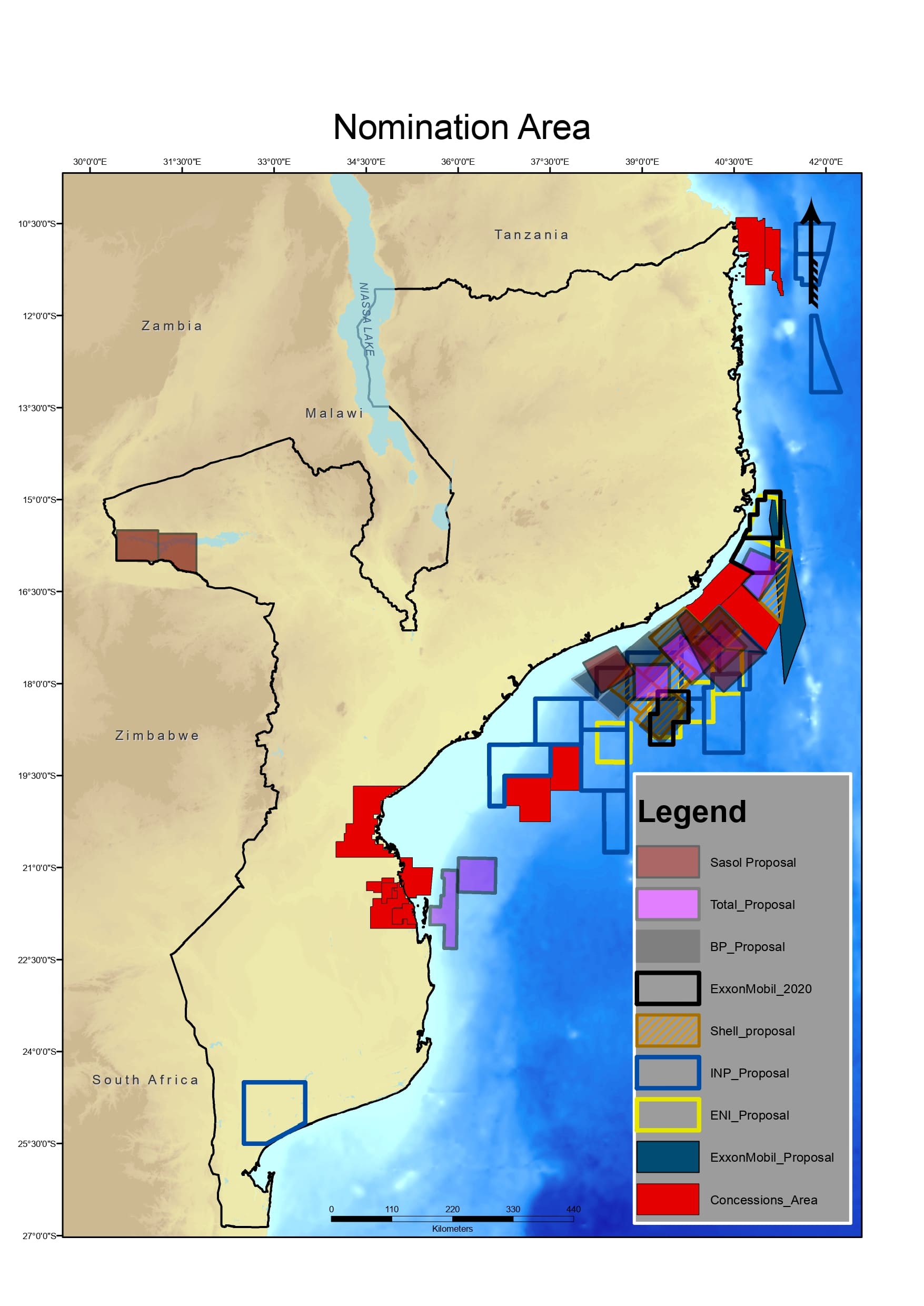
Geographical coverage of mesh
Three complementary pillars attract investors to the sector: international reference conferences, public road shows and technical workshops with operators articulated on an annual agenda.
Phase 04 · Investment PromotionThree pillars — conferences, road shows and workshops
International reference forums
Cycle of national and international agendas
From the start of the tender: Release → Pre-qualification → Assignment → Final Approval → Negotiation and Signature → Beginning of Operations — with involvement of the INP, Government, ENH and Administrative Court.
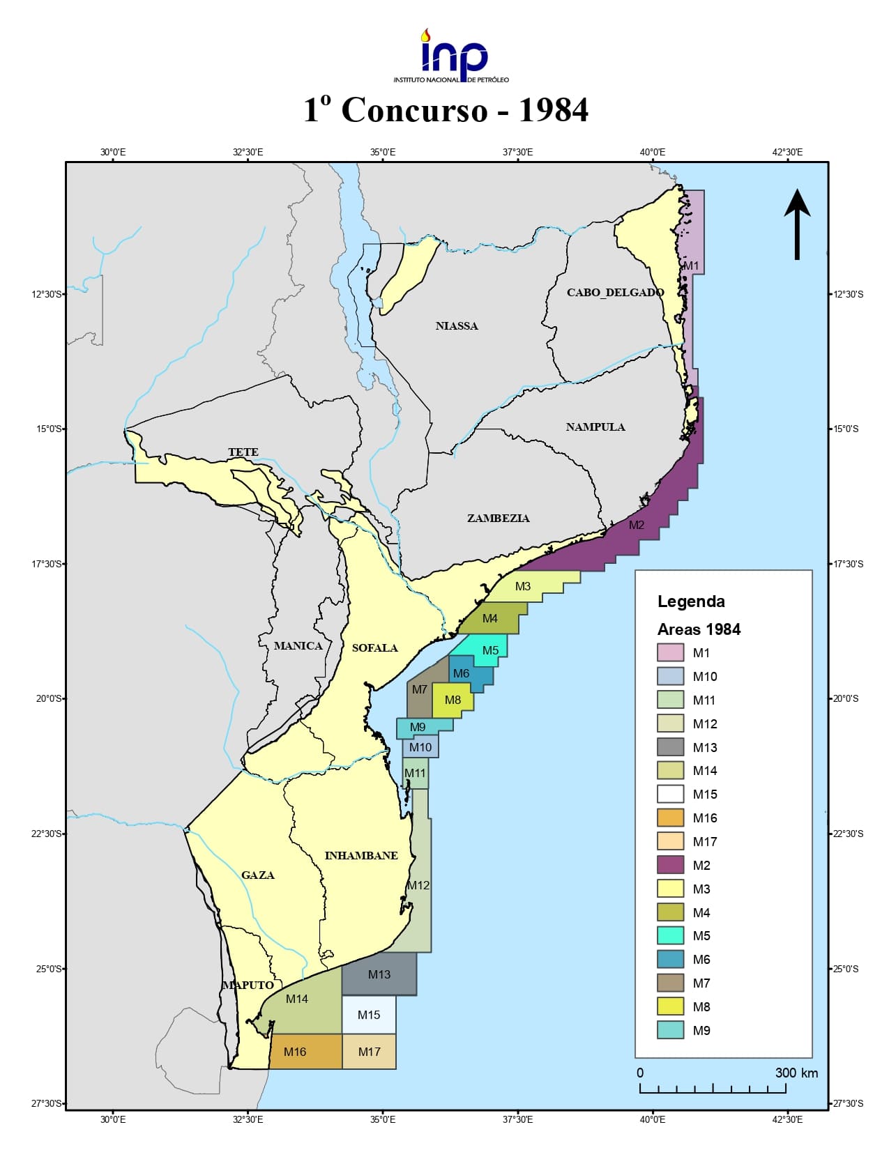
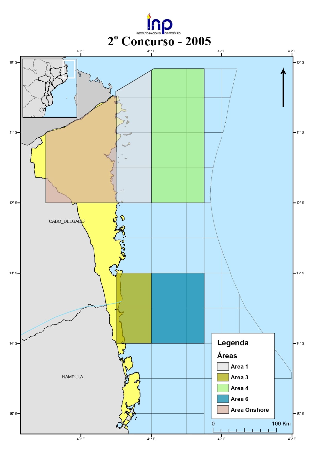
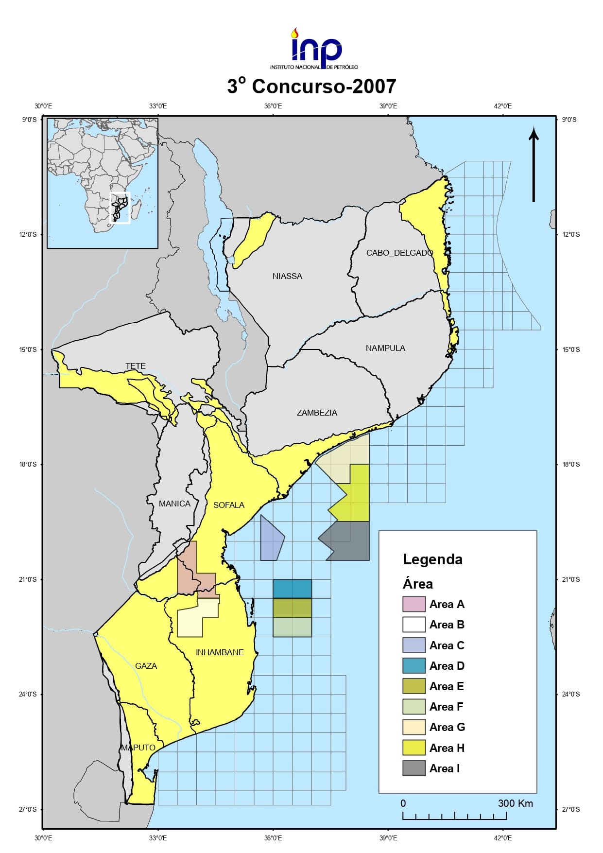
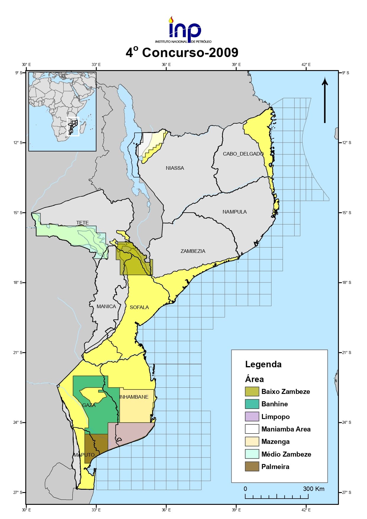
The modelling of the Regional Deposition Environment (GDE) provides for the distribution of reservoir rocks, seal and mother in the basins of Rovuma and Mozambique reducing geological risk and guiding the location of wells.
Phase 06 · Regional Deposition EnvironmentSubsea channels, deltas and fans
Key geometries identified (Rovuma)
Identified environment (Mozambican Basin)
Central objective of regional modelling
Opening wells to access the oil and gas reservoirs: drill rotation, injection of drilling mud, cemented coating and final tests in offshore or offshore operations.
Phase 07 · DrillingDrilling tower and rock layers
Two operating environments
Engineering to mitigate geological risk
Technical-economic process determining the commercial viability of a discovery after drilling: 3D geological modeling, reserve estimation and decision to invest in development or abandon.
Phase 08 · Assessment of DiscoveryChristmas tree and reservoir
Classification and registration of resources and reserves according to PRMS, the international technical system supporting management, development and transparency in the administration of national oil resources.
Phase 09 · Resource InventoryArea 1 and Area 4 — Rovuma Basin
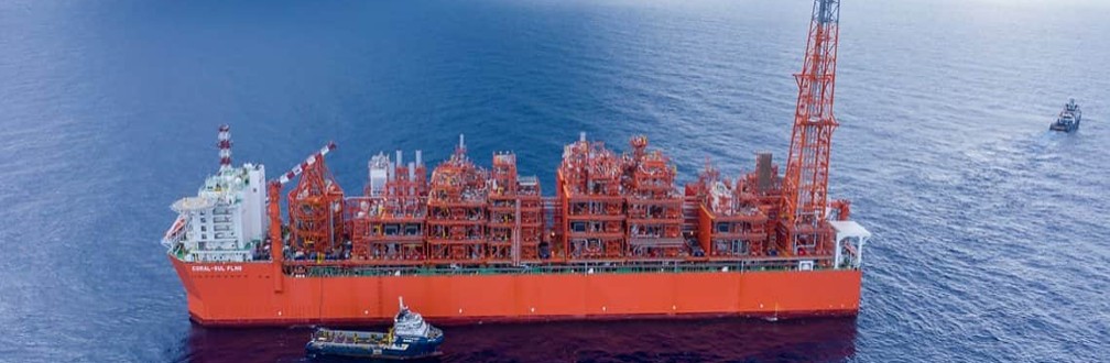
The oil and gas sector in Mozambique is characterised by the operational stability of the Coral Sul FLNG project, in production since 2022, in Area 4 of the Rovuma Basin, and by the continuous production of the Pande, Temane and Inhassoro fields, since 2004, in the Mozambique Basin, which ensure the supply to the national and international market.
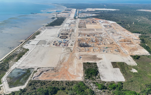
LNG Production Capacity: 13.12 MTPA (02 modules with capacity of 6.56 MTPA each).
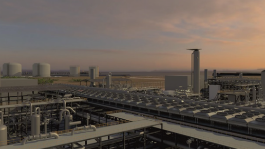
Development Plan (PoD) approved in May 2019. Supply capacity to domestic market: 500 MMSCFD.
Development Plan (PoD) approved in Feb 2016. Capacity: 3.55 MTPA.
LNG Production Capacity: 13.12 MTPA (02 modules with capacity of 6.56 MTPA each).
Development Plan (PoD) approved in May 2019. Supply capacity to domestic market: 500 MMSCFD.
Development Plan (PoD) approved in Feb 2016. Capacity: 3.55 MTPA.
The oil and gas sector in Mozambique is characterised by the operational stability of the Southern Coral FLNG, in production since 2022 (Area 4, Rovuma Basin), and the continuous production of Pande, Temane and Inhassoro since 2004 (Mozambican Basin).
State of production and main updated indicators.
Production of natural gas and connection to existing infrastructure.
Project to share production and associated development.
Gas pipelines, domestic market, exports and value chain.
Oil Regulatory Authority


Following the 2nd open competition for the granting of areas for the research and production of hydrocarbons, the companies Anadarko Mozambique Area 1 and the National Hydrocarbon Company were awarded Area 1 in offshore environment of the Rovuma Basin. The area is located in the northern part of Cabo Delgado Province, in shallow to very deep waters. The Hydrocarbon Research and Production Areas Grant Agreement (CCPP) was signed on 20 December 2006 and is effective as of 1 February 2007.
Median estimate of 43 tcf (cubic foot trillions) of gas.
4 Transzonal Reservoirs:
Median estimate of 3.4 (cubic foot trillions) Tcf of natural gas.
Median estimate of 8.4 Tcf (cubulated foot trillions) of natural gas
The Paleocene Reservoirs.
Tigris Shark Discovery Area (1254 km2), has 3 reservoirs of the Cretaceous (K1,K2 and K3), the K2 being the best in Orca and Shark-Tigre and has a median estimate of 0.323 Tcf (cubic foot trillions) of natural gas.
The complete technical evaluation of the potential of the Cretaceous in Area 1, between the Areas of Discovery Tubarão Tigre and Orca, determined that it contains small, discontinuous and low quality reservoirs, and this would probably present significant challenges in the supply of trade amounts of gas. Of the three reservoirs of Cretaceous (K1,K2 and K3) evaluated, the best is K2 in Orca and Shark-Tiger that has an average resource of 0.323 Tcf (cubic foot trillions) of natural gas.
This discovery was made in Area 1 by Anadarko in 2013 through borehole Orca-1, whose reservoir is the age of the Middle Paleocene, was subsequently evaluated by the holes Manta-1, Orca-2, Orca-3 and Orca-4.
The discovery is located about 10 km from the coast line, 250 km from the city of Pemba. This reservoir is of Middle Paleocene age and is not shared. The average estimate of resources is about 8.4 Tcf (cubulated foot trillions) of natural gas in situ, according to estimates submitted by Total.
The reservoir in the Orca discovery lies at depths ranging from 4000 to 5000m below the mid sea level, and the water column from about 600m to 1200m. The extension is about 30 km.
This discovery was made by Anadarko in January 2011 through the Jaw-1 hole and evaluated by the Shark-2 hole (negative) in 2013. The discovery is located about 25 km from the coast line, 50 Km of the Northeast of the district of Mocímboa da Praia and 200 Km of the Northeast of Pemba City.
The reservoir is completely in Area 1. The average estimate of resources is about 3.4 tcf (cubic foot trillions) of gas in situ.
The reservoir is at a depth of 3500 to 4000 metres below the average sea level. The water column ranges from 800 to 1200 meters. The extent of the Shark discovery is about 20 km east-oriented.

